Home

Main navigation

  • About
    A group of people in front of a CDA banner.
    • About the Archive
    • Board of Directors
    • Partners and Sponsors
  • Collections
    Collections
    • Designers
    • Firms
    • Clients
    • Dates
    • Project Types
    • Special Collections
  • Programming
    Programming
    • Events
  • Education
    Education
    • Education Toolbox
    • Essays
    • Resources
  • Submit
    Submit
    • Submit Your Work
  • Support
    Support
    • Support the CDA
Home

Main navigation

  • About
    A group of people in front of a CDA banner.
  • Collections
    Collections
  • Programming
    Programming
  • Education
    Education
  • Submit
    Submit
  • Support
    Support

Main navigation

  • About
    A group of people in front of a CDA banner.
    • About the Archive
    • Board of Directors
    • Partners and Sponsors
  • Collections
    Collections
    • Designers
    • Firms
    • Clients
    • Dates
    • Project Types
    • Special Collections
  • Programming
    Programming
    • Events
  • Education
    Education
    • Education Toolbox
    • Essays
    • Resources
  • Submit
    Submit
    • Submit Your Work
  • Support
    Support
    • Support the CDA

Book

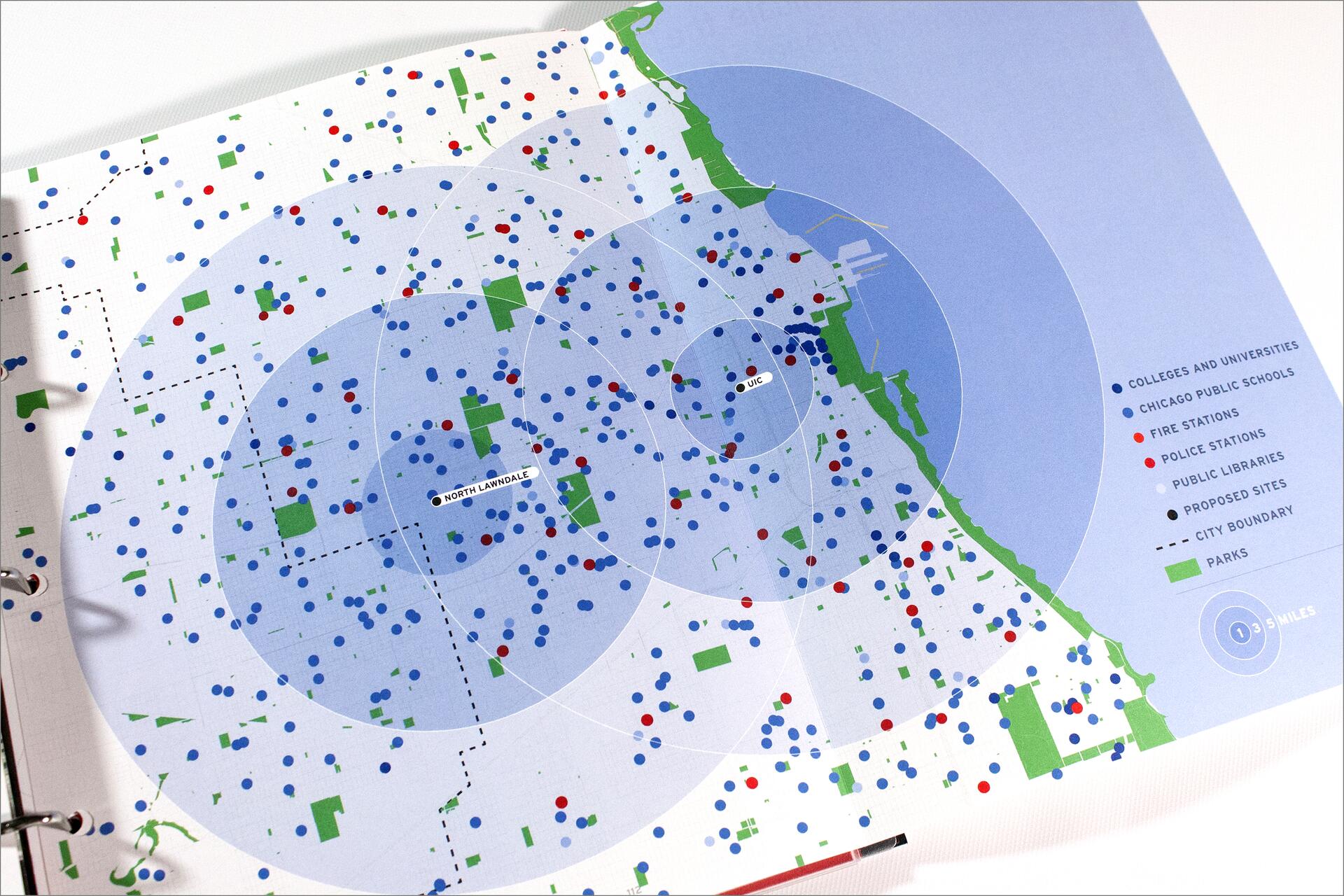
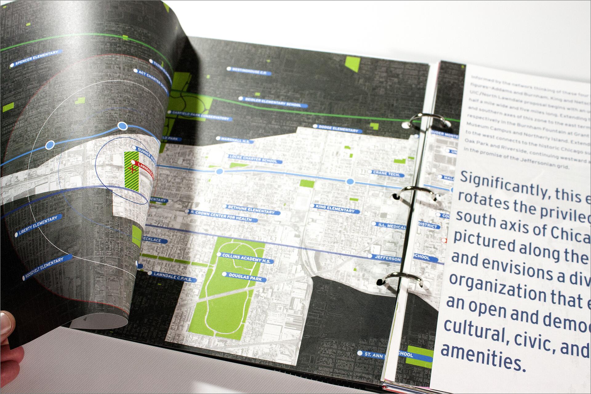
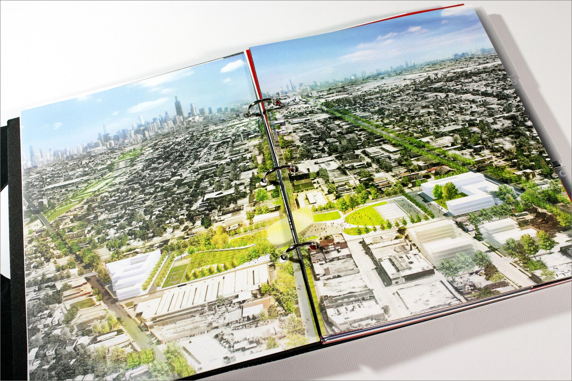
15A-24C

Book

Designer
Mary Case
Marcus Betts
Lisa Yun Lee
Michael A. Pagano
Michael Redding
Alfred Tatum
Director
Marcia Lausen
Firm
Studio/Lab
Client
Barack Obama Presidential Library
Date
2015
Project Type
Print
Collection
Archive 15
Map of Chicago with colored dots and symbols representing schools, fire stations, police stations, public libraries, and proposed sites. Areas are marked with circles indicating distance, and parks are highlighted in green.

Project Images

An open binder contains a detailed map of a city, showcasing schools and health centers marked in blue and green. A partially visible adjacent page includes text with large, bold letters.
15A-24A
Open binder displaying an aerial photograph of a cityscape, featuring densely packed buildings with a park and greenery in the foreground. A city skyline is visible in the distance under a clear blue sky.
15A-24B
Map of Chicago with colored dots and symbols representing schools, fire stations, police stations, public libraries, and proposed sites. Areas are marked with circles indicating distance, and parks are highlighted in green.
15A-24C

Footer menu

  • Contact
  • Policies
  • Rights

© 2002–2025 Chicago Design Archive. All rights reserved.